Water is the source of life. It is needed both for quenching thirst and for household needs. Therefore, for those who live far from large settlements, a well or a well is the only source of water. In order to competently provide your site with water, you need to know what an aquifer is, and at what depth it is located.
What is an aquifer
Aquifer parameters:
- Depth of occurrence. Measured in meters from the earth's surface;
- Power. This refers to the thickness of the soil, which is saturated with water;
- Performance. The volume of water, measured in cubic meters, per unit of time. It is important to know that the deeper this layer, the more constant its performance.
- The amplitude of fluctuations in water throughout the year, which depends on the amount of precipitation, season, ambient temperature and atmospheric pressure.
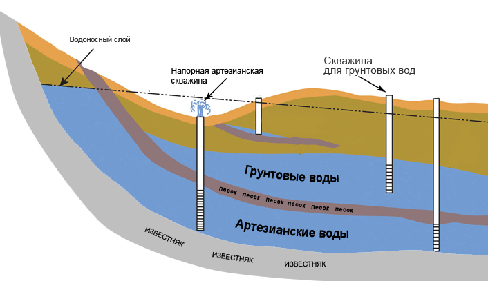
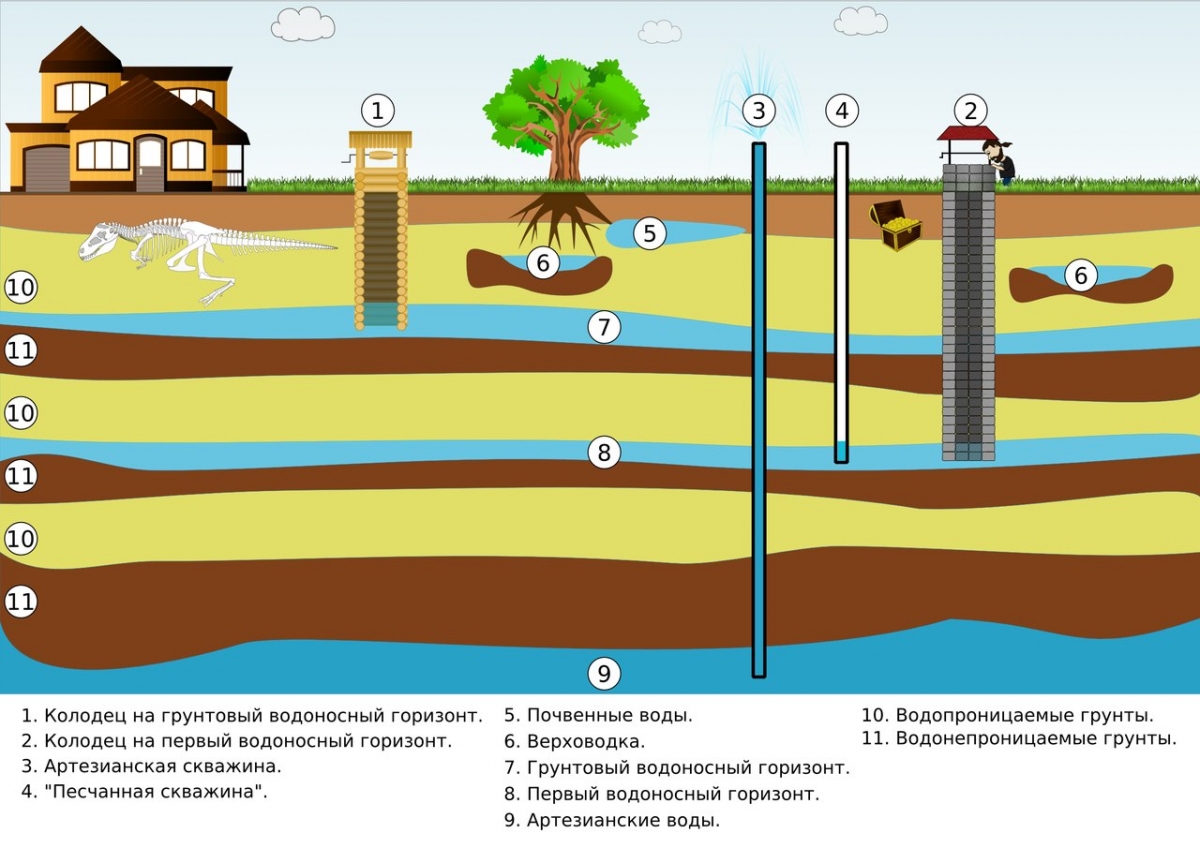
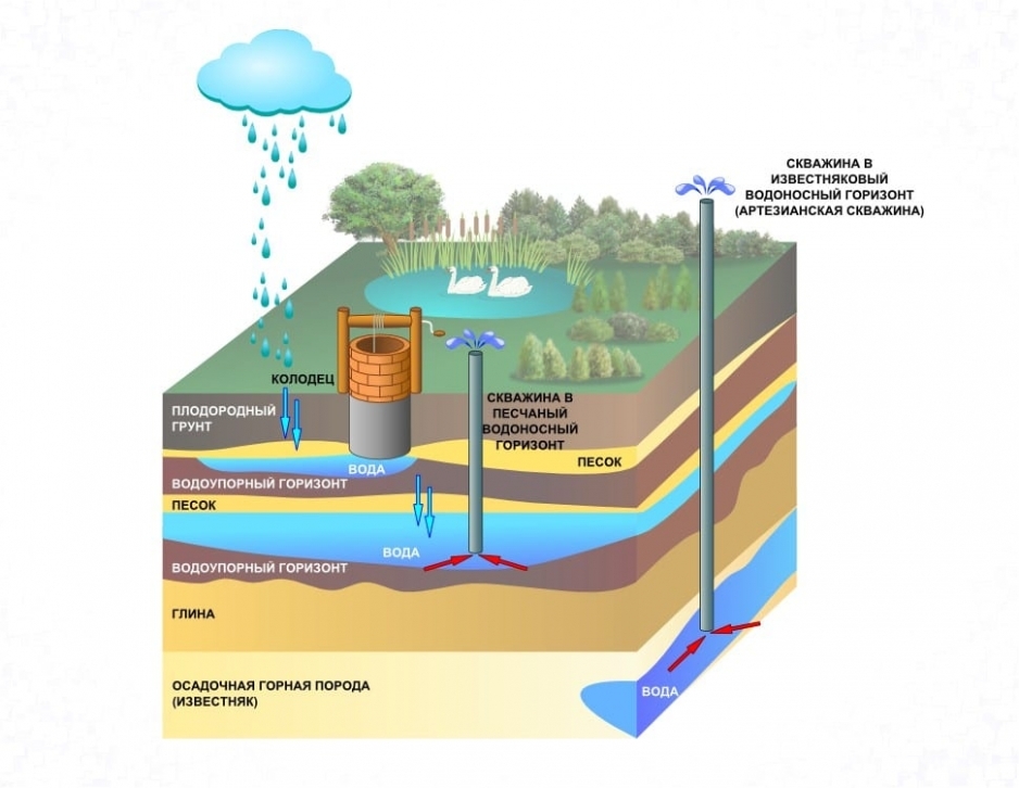
Types of aquifers
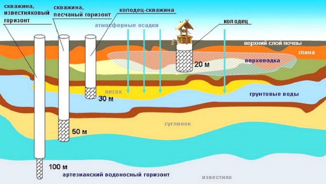
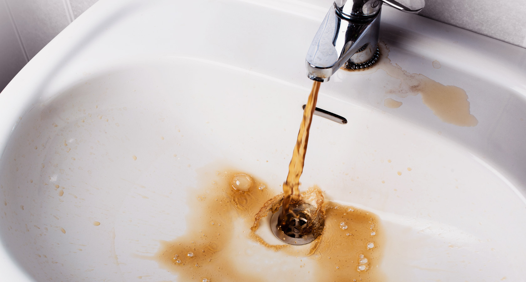
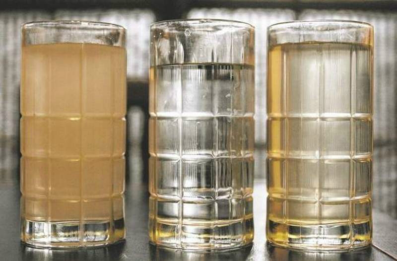
- Verkhovodka. This layer is very close to the surface of the earth, sometimes at a depth of only five meters, which is replenished from precipitation. Therefore, at high ambient temperatures and with a decrease in precipitation, the water here can be greatly reduced or even disappear. It must be remembered that this layer absorbs everything that gets in with precipitation and effluents: pollution from the soil and atmosphere, waste from enterprises and toilets with a cesspool. For this reason, it is dangerous to use the water of this layer if there is a cemetery, street toilets or industrial plants nearby. In addition, such water has a high oxygen content, which results in a high content of living microorganisms in it. In the northern regions, this layer is often exposed to freezing, so water intake from it will be difficult.
- Ground water. The depth of this layer is ten meters from the earth's surface. Its support is a layer of clay. According to experts, the water from here is also not clean enough, since this depth is not enough for its high-quality natural filtration.
- Interstratal waters. They are located at a distance of fifteen to one hundred meters from the surface of the earth. Often, the liquid is located here between two impermeable layers. This water is stable. But at the same time, it can have a high concentration of metal salts and minerals, which it absorbs into itself all the way. The use of this resource is possible after research and selection of an appropriate filtration system.
- Artesian waters. The location of these waters is below one hundred meters. It is this resource that is the cleanest possible, since it has passed a large number of stages of natural natural filtration. In accordance with the law of the Russian Federation "On Subsoil", the state controls all artesian wells, therefore, for its drilling and further use, it is necessary to obtain an appropriate license.
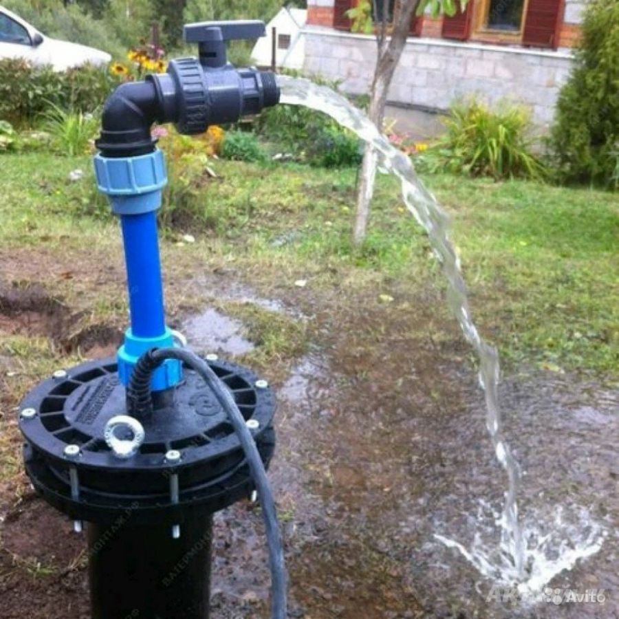
In addition, there is another classification of aquifers. They are divided into pressure and non-pressure.Thus, free-flow layers are located very close to the earth's surface, and therefore their productivity is unstable. As for the pressure layers, they are located deep underground, therefore, they do not depend on the ambient temperature and the amount of precipitation.
Aquifers map
Such maps can be found in the archives of the corresponding locality.
Aquifer maps are of the following types:
- Hydroisogypsum. This map contains information on unconfined strata. It displays the system of water movement, thanks to which it is possible to determine the direction of the resource, the sources of saturation and discharge of this layer, the slope, the places of joining with water bodies.
- Hydroisopyez. It is compiled exclusively from accurate data for artesian sources.
- Amplitude map of liquid levels in sources.
How to determine the water level while drilling
The exact depth of the location of the aquifer can be determined by specialists. But there are certain methods and even folk signs with which you can approximately find out the level of water occurrence.
So, when choosing sand when drilling, you need to pay attention to its type. The finer the grains of sand, the closer the water. If the grains of sand are large, then the aquifer is at a depth of more than eight meters.
In addition, it is important to pay attention to local plants. In places where vegetation is lush and lush even in the heat, the water is located close to the surface. So, each plant prefers places with a different location of groundwater. Here are the plants you need to pay special attention to:
| Plant | The approximate depth of the location of the aquifer |
| Rogoza | one and a half meters |
| Reed | one to three meters |
| Sarsazan | up to five meters |
| Sagebrush | seven meters |
| Sand wormwood | nine to ten meters |
| Alfalfa | fifteen meters |
It is also important to give importance to the root system of plants. If their root system is weak, then the groundwater is not far from the surface. If the roots are massive, then the aquifer is located deep enough.
How to find out the depth of an already drilled well
Once a well has been drilled, it is sometimes necessary to determine its depth. For this purpose, special tools can be used, such as:
- Hydrogeological tape measure. She measures the depth of up to fifty meters. If it is not available, you can use a cord with a weighting agent. You can use a brick or some metal object as a weighting agent.
- Special logging cable. This tool has a measuring roller, one unwinding of which is equal to one meter.
- Depth gauge. This tool measures the angle and depth of a borehole by means of an echo that is sent and then reflected from the bottom of the borehole.
To provide a land plot with water by drilling a well, it is necessary to be able to correctly determine the location of groundwater, as well as its depth. This can be done with the help of special maps and tools, as well as with the help of folk signs.